Alaska
occupies a huge peninsula, from which hand two long extensions.
To the southwest stretch the Alaska Peninsula and the Aleutian
Islands chain. To the southeast is a 500 mile long strip
bordering on British Columbia. On its eastern side the Alaskan
mainland is adjacent to Canada's Yukon Territory. Alaska's
total area is 591,004 square miles, including 20,171 square miles of
lakes and rivers. With its islands, Alaska has 33,904 miles of
shoreline.
Northward, Alaska extends the United States to Point Barrow on the
Artic Ocean. About one third of Alaska is within the Artic
Circle. Westward, the Aleutian Islands stretches across the
Pacific Ocean into the eastern hemisphere. Attu, Alaska's
westernmost island, is located at 173 E longitude. This is
directly north of New Zealand. The distance from Attu in the
Aleutians to Ketchikan in the panhandle is greater than the distance
from San Francisco to New York City.
The tip
of the Seward Peninsula, on the Alaskan mainland, is a little more
that 50 miles across the Bering Strait from the Russian mainland.
Through the Bering Strait runs the international date line. On
one side is Little Diomede Island, a part of the Untied States.
On the other side of the date line, a couple of miles away, is Big
Diomede Island, which is part of Russia.
|
|
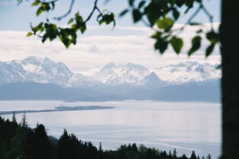
The geography of Homer — physical as well as
metaphysical — has gathered certain people here the way currents gather
driftwood on the town's pebble beaches. Homer is at the end of the
road. The nation's paved highway system comes to an abrupt
conclusion at the tip of the Homer Spit, almost 5 miles out in the middle
of Kachemak Bay, and believers of one kind or another have washed up here
for decades. The choice is understandable. Homer lies on the
north side of Kachemak Bay, a branch of lower Cook Inlet, and boasts
extraordinary productivity. The halibut fishing is exceptional.
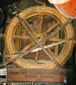
Homer began to take on its modern form after two events: in the 1950's,
the Sterling Highway connected it to the rest of the world (there were no
roads to or from Homer until then - it was only available by port), and in
1964 the Good Friday earthquake sank the Spit, narrowing a much larger
piece of land containing a small forest into the tendril that now barely
stands above water. If not for constant reinforcement by the federal
government, the Spit would have long since become an island, and Homer
probably would hardly exist.
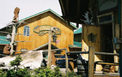
Homer is full of creative people: artists, eccentrics
and those who simply contribute to a quirky community in a beautiful
place.
|
The Homer Spit — a 5 mile long "sandbar" — is
the center of town activity with lots of unique shops, cafes and an
unforgettable
bar, The Salty Dawg |